2021 Ride the Rockies
In January of 2020, I set my sights on riding Ride the Rockies. After finishing my 5th RAGBRAI in 2019 and riding both the Buffalo Bicycle Challenge and Pedal the Plains that fall, riding the premiere bicycle tour in Colorado was something I wanted to do. As spring approached, I trained, kept my weight down, and then saw my plans change as the COVID-19 pandemic triggered the cancellation of all the summer bicycle tours. Given the choice of a refund or moving my registration to 2021, I moved my registration. Riding the Rockies would have to wait another year.
As it turned out, even if the organizers hadn’t postponed RTR in 2020, I wouldn’t have done it. In April, I had shock wave lithotripsy to break up a kidney stone, and in May, I got a deep vein thrombosis in my left calf. (These were unrelated. I’d had bouts with kidney stones for a few years, and, the best I can tell, the DVT was triggered by the abrupt transition from a super-hard Zwift ride in the late evening to sleeping without taking time to cool down and rehydrate.) The kidney stone procedure went fine, but the blood clot landed me in the emergency room. Thankfully, my complications were minimal and the clot cleared within weeks, but for that period—which would have included RTR—being on blood thinners meant I needed to minimize activities where accidents could cause bleeding. Bombing down mountain passes on a bicycle was going to be a no-go for me, pandemic or no pandemic.
As the pandemic wore on and vaccines became available, it seemed more likely that Ride the Rockies would happen in 2021. I needed to be ready, so I began the training that I hoped would prepare me for long days in the mountains.
Preparing for Ride the Rockies
I’d picked up a smart trainer at the start of the pandemic and enjoyed riding various routes in Zwift. It sure beat my old stationary bike, but I knew that if I were going to get serious about my RTR training, I should sign up for a Zwift training plan and stick to it. I started with the beginner-level “FTP Builder’ plan for six weeks starting in late December 2020, and I was pleased with the difficulty, intensity, and routine it provided me. When I wrapped that up in early February, I stepped up to the intermediate-level “Build Me Up” plan for 12 weeks, which kept me busy until early May. When I finally started riding outside again, the gains were obvious and I was besting my Strava segment times from years prior. My schedule and the weather never really allowed me to get in all-day rides in May and early June, but I was pleased with my ability to climb 2,000-3,000 feet in a workout and still feel strong.
I should also mention the preparations made by tour director Deirdre Moynihan and her RTR crew, specifically for COVID-19 mitigation. Like many COVID-19 plans, they included things that would make a big difference (promoting vaccination) and things that wouldn’t (disinfecting bike racks after each removal of a bicycle). Two precautions would prove to have a significant impact on this year’s RTR. First, everyone, including riders, crew, and vendors, had to provide proof of vaccination or show a negative COVID-19 test within 72 hours of the start of the event. Second, riders could opt-in to a catering plan so they could eat without having to enter local businesses (and, vice-versa, local business people didn’t have to assume additional risks to serve high numbers of riders). Thanks to the lifting of many state and local restrictions, we didn’t have to follow most of the precautions planned months before, and we didn’t have to travel in an impenetrable bubble. But as you’ll see, COVID-19 complications weren’t behind us, even if our behavior during RTR suggested otherwise.
Day 0: Saturday, June 12 - Drive to Durango
I’m a slow packer, so I should have known that when I had the thought, “I’d like to leave at 10 am, but it’s fine if I leave at noon,” that meant I’d be leaving for Durango at 2 pm. It’s about a 6.5-hour drive from my place in Broomfield, and I only stopped briefly in Pagosa Springs to get some dinner. I got to the camp area while there was still some daylight, so I hurriedly put up my tent in center field of the baseball diamond. I tried to assess what COVID precautions might still be in place, but it didn’t seem there were any. I didn’t see people wearing masks, the tents weren’t spaced out in a grid, and the porta-potties weren’t spaced out with doors facing in alternating directions. In other words, it looked like any other bike tour I’ve been on. I left my bike with my tent, drove up to Ft. Lewis College, and found the long-term parking. Unfortunately, the parking shuttle was no longer running, so I walked an hour in the dark back to camp. It wasn’t ideal, but I figured the walk was an acceptable punishment for being late. I got back to my tent around 10:30 and tried to get some water in me before going to sleep. Whatever amount I drank, I should have drank more.

Day 1: Sunday, June 13 - Durango Loop
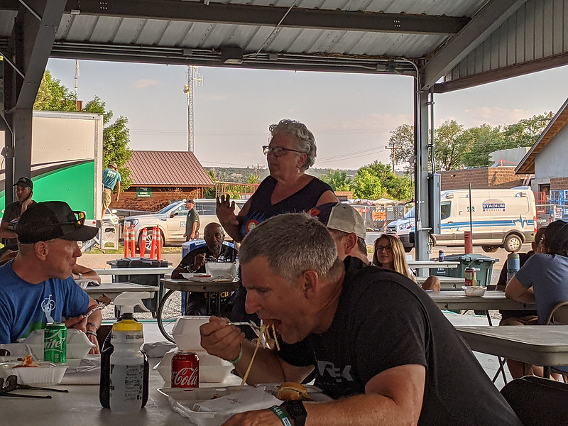
RTR organizers advertised this day as a 74.4-mile loop with 3,594 feet of climbing. Since we would finish where we started, we wouldn’t have to take down tents and pack our gear before setting out. I’d paid for the ride’s $6/morning catered oatmeal bar, so I went to the breakfast tent and sat down with an admittedly underwhelming scoop of gooey oats with a sprinkling of dried cranberries and brown sugar. The caterers didn’t wear masks, which surprised me a bit, and while there were bottles of disinfectant spray on all the tables, I never saw anyone using them.
After filling my tires with air and my bottles with water, I pedaled away from camp at 7:53 am. If I’ve learned anything about the first day of bicycle tours, it’s that there’s a natural inclination to want to push too hard and go too fast. I would have liked to have left even later, but the forecast of excessive heat pushed me and many other riders to be not so casual about this day’s ride. The first leg was a beauty, following Durango’s recreation paths downstream along the Animas River, meaning light pedaling and decent average speeds for the first hour. I was happy for that – not only was I still not rehydrated after the long car trip the day before, but I’d also gotten cold in the night and didn’t get as much sleep as I wanted to. The forecast high might have been the upper 90s, but here in the high desert of southwest Colorado, nighttime temperatures were still dropping into the high 40s.

The first aid station came at the end of the downhill, about 21 miles into the route. They had boxes and boxes of bananas, water, Scratch drinks to aid hydration, and a few other snacks. Like I’d seen in camp, I didn’t see the COVID precautions I’d heard and read about in preparation for the ride. Everyone was filling their own bottles, grabbing their own snacks, and standing close together. It didn’t bother me or make me feel unsafe, but I did feel a need to orient myself and figure out what, if any, official protocols were still in place. It looked like any other aid station stop at any other ride.
From here, we turned east and headed uphill. I’m not fast going uphill (that’s for skinny people!), but I was fast enough to keep up with others and pass the occasional rider, which helped inspire some confidence. I was expecting to see people ride wearing masks because we’d been told that was a request of the tribal leaders of the Ute Reservation, which covers much of the southwest corner of Colorado south of Highway 160, but nobody was. I later learned that the local mask restriction had been lifted the day before and I’d missed the message in my lateness getting to Durango. I pulled into the aid station in Ignacio to find a big crowd and long lines for Scratch and water. While I waited, I chatted with Jason Sumner, who is RTR’s route coordinator.
From Ignacio, it was a gentle climb north to Bayfield. I spent a couple of nights in Bayfield a few years ago and wondered who might be out on their small but cute main street to greet us. It turned out that nobody turned out, and we passed by seemingly without notice. After crossing the highway, we stopped at Bayfield High School for aid station #3. I’d paid for the sack lunch package as part of the ride catering plan, and I didn’t realize they were here until someone standing near a stack of cardboard boxes asked, “Did you get a lunch?” After saying yes, they handed me a sack with a turkey wrap, some chips, and a cookie. I was surprised they asked me the way they did, as the question, “Did you pre-pay for lunch?” would have helped make sure the only people taking them were those who paid for the catering plan. I went and sat in the shade and talked to a couple of folks while we ate.

By now, it was early afternoon and the temperatures had reached the 90s. As I made my way back to my bike, I heard a few staffers complaining about the disorganization with the lunch distribution, and I hoped it hadn’t led to anyone not getting the food they should have gotten. From here, the route continued north and kept climbing, and with my stomach busy digesting the rest of my body was sluggish. Not far from the high point of the day, with temps around 100, I finally had to pull over and take a break. A group of cyclists had found a cool patch of concrete by some mailboxes in some shade. I struck up a conversation with a guy named Virgil from North Dakota. He was riding his 10th RTR, but a broken leg in February had interrupted his regular training and he was finding the day difficult, too. I joked that maybe if we had enough stamps, the USPS could deliver us to Durango.
With some rest and time to digest lunch, I felt better and I followed Virgil’s leisurely pace to the top of the climb. A handful of medics were nearby on bikes, and a few of them had stopped to aid riders who pulled over in search of relief. A rider just in front of me was swerving in the heat, then suddenly crossed the road to find shade on the opposite side. He did this just as a car from behind was trying to pass and narrowly missed being run over. These kinds of things are an ugly reminder of how accidents can happen when you push yourself too far and your judgment gets cloudy.
The top of the climb came at about mile 58. It’d taken me almost 6 hours on the bike to get this far, which concerned me for the rest of the week. The last 16 miles were mostly all downhill back to Durango. As soon as I got back to camp, I started taking in more water. A lot of water. I knew I’d been under-hydrated all day and was paying the price, and I certainly wanted to feel better in the more challenging days to come. After a shower, I walked a few blocks to Subway, where I slowly ate a sandwich and cookies while filling and refilling my water bottle, as well as filling my phone battery from the outlet behind my booth. A nice part about being experienced at these kinds of bicycle tours is that you have a good sense of how you feel and what your body needs. My body needed water, a footlong tuna sandwich with lots of veggies, three cookies, and some quiet time in a cool space.
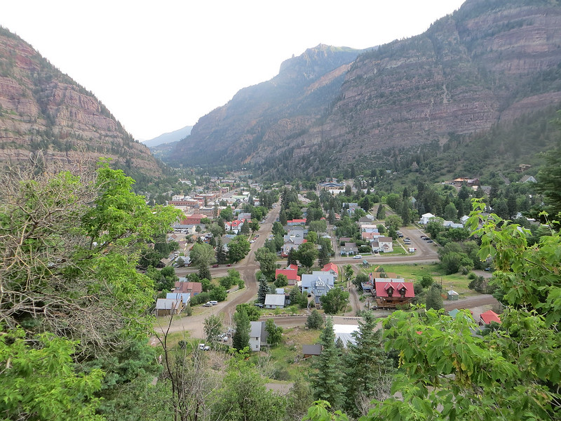
Day 2: Monday, June 14 - Durango to Cortez
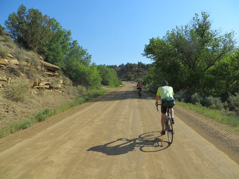
Day 2 promised a similar distance, similar climbing, and similar temperatures to Day 1 but included a 17-mile section on a packed dirt road. I don’t mind riding on some dirt and gravel, but that’s a substantial distance. If conditions were worse than advertised, it could add a significant amount of time to my day.
I woke up hydrated and rested and went to work packing my stuff and tearing down my tent. It was cold again, with temperatures in the upper 40s. I knew the day would warm up quickly, so I resisted putting on additional layers. I had a brief moment of panic when I struggled to get everything to fit in my bag. It occurred to me that, until that moment, I hadn’t attempted to squeeze everything in there. I just figured that since it was almost the same stuff I’d taken each year on RAGBRAI, it should fit about the same. It did, but barely.
I rolled out of camp at 6:45 and headed back onto Durango’s excellent riverside bike paths. Instead of following the river like the day before, we turned after 3.5 miles and headed uphill to the southwest. After climbing, then plateauing, then descending, we turned north onto the dirt road about 27 miles into the day’s ride. I heard some grumbling by other riders, but the road was better than I expected. Nearly all of it climbed steadily at grades of 0-2%, and the combination of trees and terrain to our immediate right meant that quite a bit of the riding was in the shade.
Maybe three-quarters of the way in, we reached the aid station and our lunches. Dierdre was there helping fill water bottles from a garden hose. “See, I do more than just send emails!” she said happily, which probably was just as much a moment of relief from her duties as tour director as it was a relief for thirsty riders to get a drink. Like the day before, I didn’t spot the lunch handout area right away. If I hadn’t noticed a few people walking around with paper sacks, I might have accidentally moved on without eating. I grabbed a lunch and found a shaded but unglamorous spot behind a bathroom trailer to enjoy while I ate my wrap and cookie.
Like the day before, I found that riding after eating was not a good recipe for feeling good on the bike. The route continued to climb up the dirt road until we were back at Highway 160, which we took the rest of the way to Cortez. The first few miles back on pavement was also uphill but soon switched to a long, fast downhill, then one last uphill to the entrance to Mesa Verde National Park, then the final descent into Cortez.
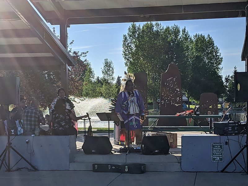
We camped at the recreation center in Cortez and it was probably the nicest setting of the tour. The grass was in good condition, there was a lovely pond and performance area nearby, and we were an easy walk away from restaurants and other services along the highway. Here the porta-potties were spaced out like we’d been told they would be, except here, there were no handwashing stations like we had in Durango. It was yet another sign of how we were still in this somewhat clumsy period of transition out of the pandemic. I asked at the information booth if I was missing something and where we should wash our hands, and they suggested washing at the water bottle filling station. That would have never been in people’s official plans, much less the COVID-19 mitigation plan, especially since it requires touching the same levers that people push with their bottles to dispense the water. Washing where people fill bottles tends to be a nuisance in my experience, so I got by with some hand sanitizer.
I sat in for Jason’s route preview and Dierdre’s announcements. The next day would be a long one, so Jason rightly stressed eating and drinking enough to sustain yourself for the 100-mile ride to Norwood. Dierdre went over the logistics for shuttling back and forth to Telluride, for those riders choosing that option, and reviewed details about getting breakfast in the morning and knowing where to expect lunch along the way.

Day 3: Tuesday, June 15 - Cortez to Norwood
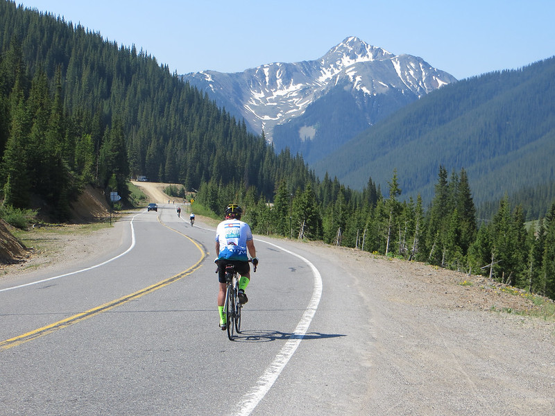
On to Lizard Head Pass! This was our biggest distance day: 100 miles from Cortez to Norwood up and over Lizard Head Pass, with a tough climb up Norwood Hill near the end. I went to the community tent for my bowl of oatmeal and was surprised to see tables full of store-bought muffins, bagels, and other breakfast foods. I asked where the oatmeal was and got a simple, “The caterers aren’t here,” as a response. These folks were from the community and I sensed they assembled this at the last minute. All I wanted was some calories to get me going, so I grabbed a muffin and rolled out of camp at 6:40.

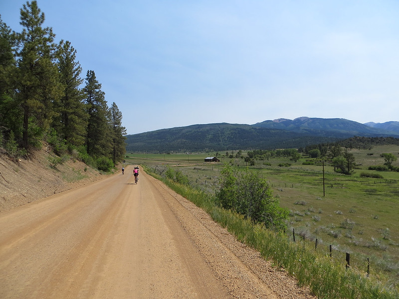
I joined the crowd heading north out of Cortez, past the agricultural fields and towards the small town of Dolores, the site of our first aid station. I wondered if maybe the caterers would be here since the aid station was conveniently located only about 11 miles into the day’s ride. But nope, it was just the usual assortment of pretzels, fruit, water, and Scratch, so I filled my pockets and set off again. From here, the route followed the Dolores River, which offered beautiful views and a cool microclimate at the bottom of the canyon. We were at 6,850 feet of elevation and we’d follow the river gently uphill for more than 2,000 feet.

After 48 miles and 2,000 feet of climbing, we reached the small mountain town of Rico, site of an aid station and our lunch. Except there was no lunch! Depending on which group I was standing in, people said the caterers had quit, or been fired. We were also momentarily out of Scratch and some people were eating multiple snack-sized bags of Cheetos to try to fuel their body for the 50+ miles still to go. Someone had bought some jars of peanut butter, but there wasn’t much to put it on. I wondered why someone wasn’t buying more food for us, but then someone said there was a power outage in town and the stores had closed. Not much seemed to be going right. Rico is a town of fewer than 250 people, so it’s not like there was a big grocery store or restaurants to feed all of us hungry riders. As bike tours go, it was an ugly situation.

A woman with a cowbell and a basket of cookies saved my day. I happily gave her $6 for two large oatmeal chocolate chip cookies. Combined with some pretzels and rest in the shade, I finally felt like getting back on the road. It was almost noon and there were still about 12 miles and 1300 feet of climbing to get to Lizard Head Pass and the next aid station.

The climb got steeper nearer the pass, but only slightly so. I was part of a small group that pulled over for some shade and relaxation at the chain station. I kidded with another cyclist that we should put our tire chains on in the event it got icy, but he just looked at me in a high-altitude stupor, not getting the joke. As I approached the pass, the gradient leveled off and I saw the welcome sights of tents, lines of cyclists, and piles of bikes. For what was lacking at Rico, Lizard Head was well-stocked with lunch, snacks, smoothies, and plenty of liquids. It didn’t offer much shade, but the heat was less of an issue at 10,000+ feet of elevation.

I spent probably 45 minutes at the aid station before setting out again a little after 2 pm. This was the part of the whole tour that had worried me the most: the big downhills. I’ve had a couple of close calls on steeper descents in the past (braking until my front tire blew and threw me over the handlebars, fighting a high-speed wobble and narrowly missing an oncoming SUV), so I’m more cautious with my speed than most. Thankfully, this turned out to be okay, requiring some light braking to keep things to a “reasonable” 40 mph and pulling over once to snap a photo of a lake. After a few miles, we turned to take a gravel road for more of the downhill, which slowed everyone down. The road conditions were pretty good, but some blind corners and loose spots warranted some patience. The gravel kept us away from the highway, where car traffic to Telluride made that road dangerous in a different way. There was another aid station on the gravel road, and this one turned out to be a couple of coolers, no food, no volunteers, and a single forest service toilet. I laughed with Bridget from Buffalo at the meager accommodations, but we agreed that it was better than nothing. After all, we were still riding our bikes in a beautiful place.

We reached Highway 145 and the pavement with about 17 miles left to go. Ahead of us were miles of paved roads sloping slightly downhill as we followed the San Miguel River, except for Norwood Hill, one of the steeper bits of sustained climbing we’d see all week. I’m strong on the slightly downhill, even with headwinds, which boosted my confidence and helped my pace for 12 miles. There was another aid station along the way. This station was staffed with volunteers, but there was little aid for them to give. We had water and a few boxes of clementines, but the rest of the food was gone. The volunteer (who had come from Virginia to help as her daughter rode) was frustrated, and so were the riders. At least here, there was some shade and a hose with running water so some riders could spray themselves down for temporary relief from the heat.
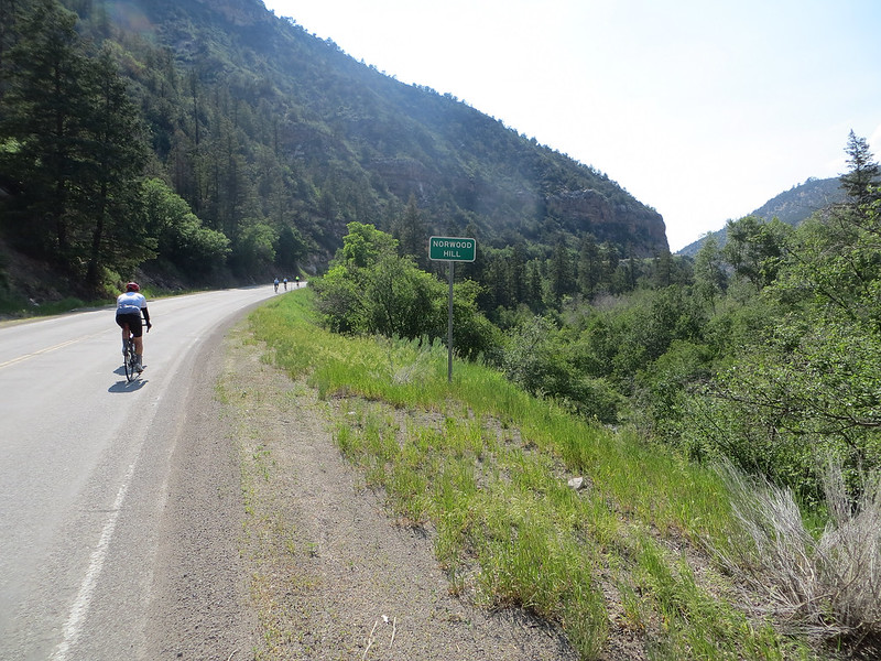
Norwood Hill (a.k.a., the Norwood Crusher) is a climb of less than 2 miles, but it ascends almost 700 feet with an average gradient of 6.8%. That’s not much of a challenge for a professional cyclist, but plenty for a heavier rider like me. I settled in, ground it out, and was pleased with myself for never stopping. Still, it took me over 24 minutes, well short of the 8:49 record on Strava.
Finally, it was downhill and a straight shot west into Norwood for the last 3 miles. My Garmin warned me about a low battery, so I used that as motivation to ride just a little faster. Nobody wants to lose data after a 100-mile day. Once in town, I turned a couple of blocks off the highway to the sprawling complex of school and fairgrounds. I gathered my bag and found a spot for my tent at the back of the football field before heading off to get more water. It was about 5:30 by this time, and I knew I’d have to move a bit more quickly to get everything done by dark. So it was quick into the shower, a little organizing in the tent, and then off to find dinner. With the caterers gone, the whole town of Norwood pitched in to make sure we got fed. I got in a line where happy volunteers presented me with a choice of pasta, burgers, or deli sandwiches. I opted for a burger and fries and gladly accepted two beef patties. Later I grabbed a second helping of fries and a sandwich. You get hungry after such a long day. I was in the community tent when Dierdre gave her updates as the tour director. She confirmed that the caterers had dropped out with an email at 3 am, and it was a scramble to get us food for the day. Thankfully, both the people of Cortez and Norwood came through for us. Some riders weren’t happy that the plans had changed, but everyone appreciated the communities’ efforts to help out when we needed them.
After dinner, I took a walk around the town. It’s not like my legs needed more work, but with a big meal and a busy day, it was nice to have some quiet time before it got dark. Norwood is an international dark sky community, so the views of the stars there are hard to beat. I stopped to enjoy the view on my trips to the porta-potty, which were a welcome sign my body was rehydrating after such a long day in the sun. As I settled into my tent, I also found that Norwood is an excellent place to listen to dogs bark and howl after dark. Seriously, they’re really good at it. Thankfully, after a 100-mile day, it takes more than some barking in the distance to keep you from falling asleep.
Day 4: Wednesday, June 16 - Norwood to Ridgway
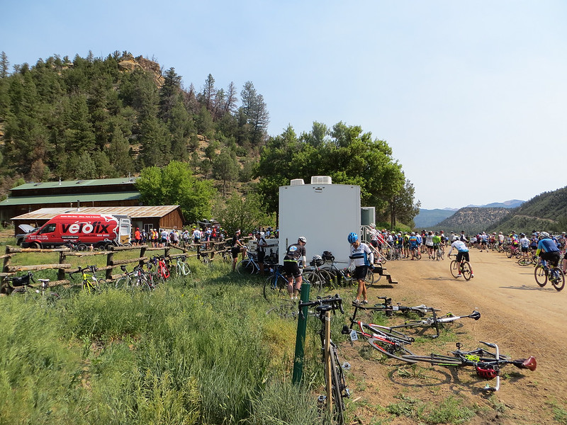
With only a 40 mile route from Norwood to Ridgway, the day’s plan called for a rolling start somewhere between 7:00 and 11:00. I felt no need to rush. I took my bike over to the mechanic at the Velofix van. Amazingly, for a ride of 2,000 riders, we had just one van and one mechanic. A veteran rider told me that typically there’d be a handful of other bike shops in camp and along the route. However, because of the pandemic and more people riding bicycles, bike shops had little inventory on the shelves but plenty of work for their mechanics to bring in revenue and keep the shops afloat. With demand high in their shops, they couldn’t afford to send mechanics to Ride the Rockies.
With my shifting issue worked out, I headed back to the football field to take down my tent. All but one rider was gone! I didn’t realize that “rolling start between 7 and 11” meant “everyone is gone by 9.” I hurried to get my stuff packed, feeling a bit embarrassed to be the last tent off the field. A few other people were bringing bags to the truck at the same time I was, and as I pulled away from the school, a bus full of riders from Telluride came in on the hotel shuttle. I took some comfort knowing I wouldn’t be the last cyclist on the road.
Dierdre told us the evening before that there’d be no breakfast in camp, but we could get breakfast with our breakfast tickets at the first aid station. I figured that would be about 15 miles in, but I rode along with some folks from Ft. Collins who said it was at mile 17. I was hungry, to be sure, but told myself I was fine. We kept pedaling to—and past—mile 17, with no sign of an aid station. Someone from a private caravan said we must have missed it, but there was no way. So we kept going, and finally at mile 21 we found it. By that point, I’d been riding two hours and climbing 1400 feet on an empty stomach. I waited for probably close to 45 minutes in a long food line for some breakfast. By the time I got to the front, breakfast had turned into chicken tacos, but boy, were they good. Later, I learned that the porta-potty company dropped the porta-potties at the wrong place, which meant the whole aid station had to move farther down the road. I’ve said before that I wish bike tours would adopt what3words to aid in locating important services. I don’t know if it would have helped in this specific case, but I’d have preferred to see the aid station at ///shoestring.lotion.delay instead of ///superb.completed.dippy.

It was about nine more miles to the summit of Dallas Divide, where we topped out at about 9,000 feet with outstanding views of Mt. Sneffels to our south. I met up with Virgil from North Dakota for a bit of this stretch, and we did each other favors by taking pictures of each other near an intersection with Last Dollar Road. A little way down from the top there was another aid station, this time with smoothies and more outstanding views of Mt. Sneffels and the surrounding peaks. They were wrapping things up for the day, but since it was all downhill from there into town, I didn’t mind taking my time.
After a descent on broad shoulders hitting 45 mph, I slowed as I entered Ridgway and was impressed by the little businesses downtown, the nice park with the big shade trees, and the Uncompahgre River flowing through town. Camping amidst those shade trees would have been very nice, but instead, signs directed me to the fairgrounds and the rocky dust bowl of the infield of their race track. Because I got there late, the lump-free spots were long gone. So I cheated a little and set up my tent just beyond the track in a little grassy strip next to an irrigation ditch. It turned out to be an excellent decision, as the ground was softer, I was upwind of the dust, and it put me in reasonable proximity of the community tent, showers, and porta-potties.

After cleaning up, I hung around the community tent for more updates. Jason gave the route update for the next day and Dierdre went into more detail about the catering situation. If I pieced it together correctly, what happened was this: Just like the riders and the RTR crew, the caterers and vendors were required to be vaccinated or show proof of a negative test at the start of the ride. But as we got started in Durango, the caterer’s chef got injured, necessitating flying in a replacement chef from Denver. That got them through Day 1, but it turned out that the replacement chef was infected with COVID-19. I don’t know if the chef showed symptoms or not, but I think they got tested on Day 2 and showed a positive result. Either way, it meant both the first and second chefs were out of RTR. There was little risk to the riders since we were more than 80% vaccinated, and we didn’t have direct contact with the chef. But for the caterers, it turned what was already a challenging job into an impossible job, and they chose to withdraw entirely. Dierdre hoped they’d be back to serve us on a limited basis, but they never returned. A different catering company filled in with some simpler meals, but it wasn’t what people thought they’d be getting.

With that new information, I walked into town for dinner in quest of food of my own. I found a Mexican restaurant, El Agava Azul, and I waited for more than 45 minutes before getting a table. I ordered the special, a big plate of nachos with chicken. I ate while charging my phone and drinking several glasses of water. After dinner, on the way back to camp, I noticed that the town ice cream shop was closed. Apparently, they’re always closed on Wednesdays. Did they not know that Ride the Rockies was coming to town? I know it’s nice to have a day off, but with a bunch of hot, hungry cyclists in town, I think we could have made it worth their while to be open.

Ridgway is the location where the movie True Grit was filmed (the 1969 original with John Wayne, not the remake with Jeff Bridges) and they had an evening showing in one of the fairground buildings. I got there about halfway through and stretched out on the floor to watch the rest. This was one of those moments where I was thankful that so many of us were vaccinated, as indoor gatherings weren’t something we were sure we could do just a few weeks prior to the ride. After the movie, I filed out and headed to bed.

Day 5: Thursday, June 17 - Ridgway Loop
Riders had essentially three options this day: (1) ride a 30ish-mile loop then head back to town, (2) ride the loop but take a trip back up Dallas Divide to visit a True Grit shooting location, or (3) take the day off entirely. I chose the first option and enjoyed a leisurely start to my morning, getting on the road at about 8:45.

The ride started on some recreation trails to Ridgway State Park, then followed the highway north to the little town of Colona. It was mile after mile of gentle descents—enjoyable at first, but then you can’t help but think, “I’m going to have to climb back up all that, right?” In reality, the total descent was only 600 feet, but the speeds of the highway made it feel like it was more than that on the 15-mile stretch to Colona and the first aid station.

This aid station was maybe the best-stocked of the whole tour. It had the four aid-station food groups: water, electrolytes, sweet snacks (cookies!), and salty snacks. I chatted with an ex-car dealer from the Chicago area before getting back on the bike and heading uphill on a dirt road. Things got hot quickly as we climbed 1400 feet in about 8 miles with little shade and little breeze. I emptied both of my water bottles along the way, and other cyclists were doing the same. A man named Jim from Phoenix kept me company for part of it, and somehow struggling with the heat together was easier than doing it alone. The gradient eased for the last few miles uphill, where we were greeted with more excellent views of Mt. Sneffels. Some clever Cookie Monster-themed signs warned me that cookies were ahead, and after a short distance, I spotted some happy people at a table in a driveway with cookies laid out on a folding table. Amazingly, this was the only time I saw something like this during the whole Ride the Rockies. Finally, we came to a steep, switchbacked, 1000-foot descent back down to the valley. A tour worker advised us when we got to the highway that we could go uphill to aid stations and the extended part of the route, or head downhill back into town. The other cyclists around me were also out of water, so we headed down. This was another example of not having an aid station where we really needed one.

For a late lunch, I headed to the True Grit Cafe and had a burrito. As you might guess, the whole restaurant was John Wayne-themed with pictures and movie posters, along with many mounted animal heads. I wandered back to camp after eating to catch the announcements at the community tent. Jason gave a preview of the next day’s route, but Dierdre was delayed and didn’t give her regular update. After having problems with aid stations the past couple of days, I didn’t want any troubles during the last day, but no information was given. When Dierdre did arrive, I heard her telling someone she had to go to Ouray because some riders had set up their tents in their park without permission and didn’t comply with city officials when they were asked to move. As if the tour director doesn’t have enough to deal with!

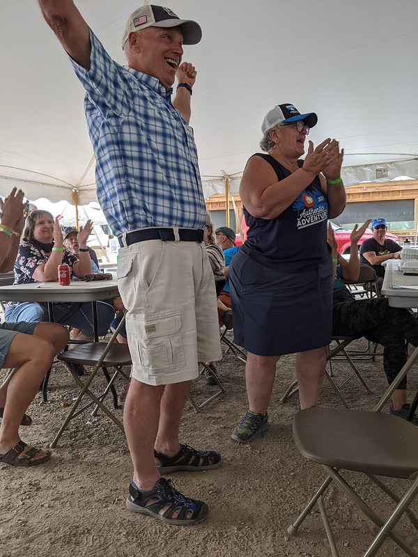
The community events moved on to recognize riders with at least ten years of riding Ride the Rockies. One energetic man did a Q&A about his experience on RTR. He’d ridden 34 tours, and all 35 if you count his first: He was out for a casual bike ride in Denver when he came across a group of people looking happy on bikes, and he thought, “Where are they going? I’m going to follow them!” He kept going all the way downtown, where they passed under a banner recognizing the finish for the very first Ride the Rockies. It was a good story, and most seem to agree that by riding part of the last stage of RTR 1, he gets credit for riding them all.
I set out for some dinner after the presentations. It hadn’t been that long since I ate my late lunch, but pedaling a bicycle day after day can rev up your appetite. There was a pizza place nearby called Panny’s Pizza that I’d tried going to the day before, but they closed early after running out of ingredients. This time I had better luck, and they served me one of the best veggie pizzas I’ve ever had. I sat with David from Phoenix, whose New York City accent gave away that he wasn’t an Arizona native. As I finished, two riders sat at the table next to me. One wore a 1999 RAGBRAI T-shirt that revealed a great story. In 1978, as a 17-year-old from Ohio working at a bike shop, he learned of RAGBRAI from a PBS documentary. So he packed up his bike and some camping gear and took a Greyhound bus to Sioux City to join that year’s ride. When it ended at the Mississippi River, he just continued riding across Illinois and Indiana to get back home to Ohio. He returned to RAGBRAI seven years later, in 1985, then again seven years later, in 1992, and then again seven years later, in 1999. He hasn’t been back since, so we had fun talking about what’s changed and what’s still the same.
Back at camp, I got in a long but wonderful conversation with my neighbor, Eric from Norwood. Yes, the tiny Norwood we’d just ridden from the day before. He was a firefighter with the Forest Service and his wife was a teacher. We talked about the ride, small towns, community, fighting fires, and various other things. We finally wrapped up as it was getting dark. He had the luxury of leaving his tent behind the next morning, as he would pick it up as he drove back to Norwood from Durango. On the other hand, I’d need to pack up and get an early start for what was sure to be a very big final day.
Day 6: Friday, June 18
The Million-Dollar Highway. Red Mountain Pass. Molas Pass. Coal Bank Pass. 80 miles. 7,500 feet of climbing. The queen stage!
I pedaled out of Ridgway at 6:11 am, an excellent start for me. The planned route added a couple of miles to follow the river instead of the highway, but in our briefing the day before, Jason suggested we just take 550 south for the most direct route to Ouray. That sounded good to me. It was 12 easy miles and 800 feet of climbing to downtown Ouray, where Bridget from Buffalo and I spotted each other again. When riding with 2,000 strangers, it’s nice that by the end of the week some of the faces start to look less strange.

The aid station was a bit higher at the so-called “Switzerland of America” lookout point. From here, it was 3,000 feet of climbing in about 12 miles to the top of Red Mountain Pass. That’s about a 5.5% average gradient, which isn’t very steep but isn’t not steep, either. In other words, I spent a couple of hours pedaling steadily in my lowest gear. The best part was that in the tight canyon, I was in the shade where temperatures hovered around 50 degrees until 8:20 am when we finally got hit by the sun. It took another hour to get to Red Mountain Pass. I hadn’t climbed fast, but I felt great. I got a breakfast burrito, some snacks, and more drinks.

I left there about 10 am, and it was a fast but not-too-fast downhill from there to Silverton, where the day’s third aid station awaited us. Given that I’d hardly turned a pedal on the descent from Red Mountain, there wasn’t much I needed here. I grabbed a cookie and topped up my bottles. I figured I’d be in good shape to make it to the next aid station, which I assumed would be on the top of either Molas Pass or Coal Bank Pass.

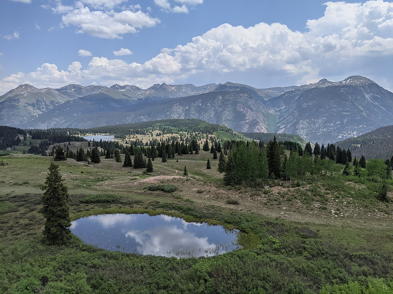
That assumption didn’t work out very well. The climb up Molas Pass was similar in steepness but only about 1,700 feet. It offers excellent views of the Grenadier Range, including the unmistakable Wham Ridge on Vestal Peak. I got to Molas Pass before noon, still feeling pretty good. But there was no aid station! I figured it must be on the next pass, so I took some pictures then got back on the bike. Not only was I eager to rehydrate, but I felt a few raindrops and wanted to stay ahead of the weather. Riding in the rain isn’t fun. Your brakes don’t work as well, your tires don’t grip the road, and at these elevations, being wet in 40-degree weather is a real possibility best avoided. I knew it was time to get down the road.
The descent off Molas towards Coal Bank Pass is a relatively short 1,100 feet, followed by an 800-foot climb up to the pass. Raindrops kept falling, but just as isolated drops. A few riders pulled over to put on jackets, but I didn’t think we were at that point quite yet. I was out of water when I got to the pass, and again, there was no aid station. I guess I should have studied the map, but even if I had, it wouldn’t have mattered. I still needed to drink everything I had over those two climbs. Aid station #4 was at the Purgatory ski area, eight miles away and 1,800 feet downhill. That made it 21 miles between aid station #3 and aid station #4, which would be quite a bit on flat terrain in pleasant weather. On this terrain, it took me about 2.5 total hours to get from #3 to #4, which is too far for comfort.

Finally, I got to Purgatory at about 1:15 pm, where I found water, Scratch, smoothies, and some simple snacks. No porta-potties, though, so riders were sneaking into the bushes for their nature breaks. Here at lower elevations, it was a bit warmer and the raindrops weren’t so threatening, although there was the noise of some distant thunder. Everyone was talking about the long distance between aid stations, and one said that the route to Durango had been changed and there would be no aid station #5. We were still more than 25 miles from the end, and the original plan was to leave the highway and come back into Durango along the Animas River with an aid station along the way. But, in a now-familiar story, the porta-potties weren’t delivered to the planned location for aid station #5. So in a last-minute decision, the route was changed to follow Highway 550 all the way into Durango, the most direct route. I shared the news with other riders, but I’m sure many left the aid station without knowing it would be the last aid before the end.
The first stretch out of Purgatory was flat but wet, as rain must have moved through before I got there. Then it sped downhill for about 10 miles, most of which I could take at full speed, passing other riders along the way. The last 10 miles were slightly downhill, which as I’ve mentioned, suits me very well. Feeling good on that terrain, I cranked up whatever watts I had left in my legs and averaged 21.4 mph over an 11-mile stretch that descended at a mere -0.3%. After going slowly uphill much of the week, it was a nice change of pace.
I got to the finish at about 2:30 pm, which wasn’t bad for such a long day. Things were a scramble at the finish, though. I got my bag, found the shower truck, and cleaned up. Then I found a safe space for my bike and bag while I waited in line for the shuttle to the long-term parking. Shuttles were scheduled to leave every 15 minutes, but that turned out to be a very optimistic estimation. I remember getting in line at 3:46 pm, just missing the previous shuttle. David from Phoenix was on one side of me in line, and a guy from Burlington, Iowa, was on the other side. David was driving back to Phoenix that night, and I hoped to drive back to Broomfield, so we were eager to get moving. It took more than a half-hour for the next shuttle to arrive, and it was nearly 5 pm by the time I made the round trip to the long-term parking and back to my bike and bag.
I was worried I’d get sleepy as soon as I started driving, but thankfully, that wasn’t the case. I stopped at City Market in Pagosa Springs for a deli sandwich, chips, gummi bears, and chocolate milk. Then it was drive, drive, drive. I did get tired as I went over Kenosha Pass and down Highway 285 towards Denver. It helped that I’ve driven that road dozens of times. Finally, I arrived home just before midnight. It’d been an eight pass day! Red Mountain, Molas, and Coal Bank by bike, then Wolf Creek, Poncha, Trout Creek, Red Hill, and Kenosha by car.
Epilogue
I’m finishing writing this a week after getting home from Ride the Rockies. The big news is that Deirdre Moynihan, the ride director, submitted her resignation to the Denver Post Community Foundation, the owners of both Ride the Rockies and Pedal the Plains. That’s too bad, but I get it. Deirdre has an engaging personality that I appreciated on the webinars, when I saw her at the aid stations, and when she addressed us during the community updates. And as I understand it, she has 15+ years of experience organizing bike rides and tours. But this year, a lot just didn’t seem to go to plan, and it wasn’t just the catering. It was the aid station placements. And the meager food at some of them. And the inconsistent and unclear COVID mitigation strategies. And the single mechanic for the whole ride. And the lack of community involvement. And probably other things I don’t know about or forgot to mention.

The thing is, it’s all complicated. COVID restrictions eased just weeks before the ride, and that’s not something under the director’s control. Porta-potties that are ordered and not delivered aren’t totally under the director’s control. Bike shops you used to be able to count on—but not this year—isn’t something totally under the director’s control. The lack of community involvement was planned as a feature of the ride, not a problem! For safety, we were supposed to travel in our own bubble that could be kept mostly separate from the community bubbles. That’s the primary reason why we needed catering, and that need only went away in the month before the ride. A whole lot of plans shifted and time spent on COVID before the ride was time that would normally be spent on other priorities. My sense is that Dierdre worked extra hard to make this year’s ride happen, but a lot of her efforts went towards things that ultimately didn’t make much of a difference. The unused spray bottles of disinfectant on all the tables at the community tent now seem symbolic of this year’s RTR.
Veteran Ride the Rockies participants told me not to judge RTR by this year’s ride. I’m okay with doing that. But I know other riders were not okay. They didn’t want so much gravel riding. They didn’t want unreliable catering. They didn’t want aid stations that were 20+ miles apart. And because of all that, they’re questioning if they want to participate in Ride the Rockies again. Ride the Rockies is about $600 just for registration, and riders want to feel like they’re being cared for in exchange. That’s fair. So like a lot of things currently, it’s a bit of a mess. Cleaning up this mess and making sure it doesn’t happen next year will be a lot of work, and with Dierdre’s resignation, that work will fall to someone else. I’d like to ride RTR again, so we’ll see what future organizers have to offer.
Want more photos? Browse my album on Flickr.

